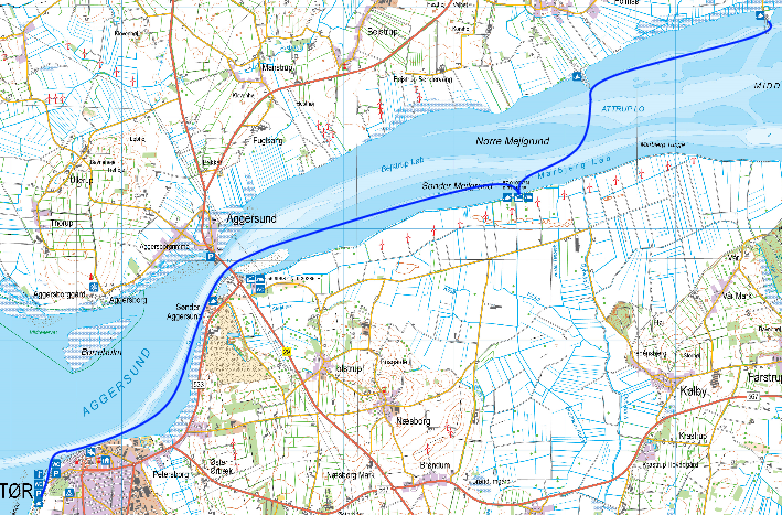
Kajakkort - Limfjord

Leg: Attrup-Løgstør: 16 km

  Løgstør-Attrup


Shelters i Haverslev Havn (Josef Slot)

Shelters at Haverslev Havn (Josef Slot)


Shelters ved Nørrekær Enge (Josef Slot)

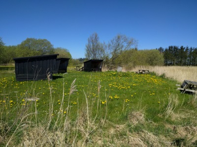
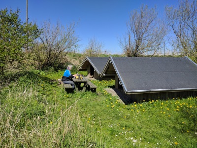
Shelters at Nørrekær Enge (Josef Slot)


Udsigt fra Nørrekær Enge (Josef Slot)

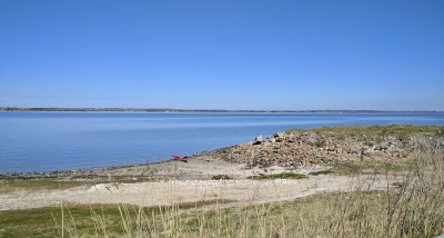
View from Nørrekær Enge (Josef Slot)


Starting point:

Attrup Habour (Attrup Havn) (GPS: 57.038783°N, 9.455186°E). There is free parking in the harbour. You can start from the slipway found in the north-eastern part of the harbour. 

Ending point:

Løgstør Rowing Club (Løgstør Roklub) (GPS: 56.965099°N, 9.242000°E). You may use the ramp at the rowing club to pull your kayaks out of the water.

Difficulty:

 Easy

Special conditions:

There are several places with shallow water along the route. Follow the waterway and be careful of larger vessels as the waterway is very narrow. Sometimes there is a strong current beneath the Aggersund Bridge (Aggersundbro). 

Protection and considerations:

None

Facilities:

Accommodation:

  • Three shelters at Haverslev Havn. (GPS: 57.030205°N, 9.401145°E)
  • Two shelters at Nørrekær Enge. Table/bench sets and campfire. (GPS: 57.010074°N, 9.379690°E)
  • Shelter and campsite south-east of the Aggersund Bridge. (GPS: 56.996874°N, 9.302850°E)

Toilets/shower:

  • Toilet in Attrup Habour.
  • Toilet in Haverslev Habour
  • Toilet at the shelter at Nørrekær Eng. 
  • Toilets in Løgstør Habour

Where to eat:

  • Attrup Habour
  • Løgstør. Several places.

Shopping:

  • Super Brugsen (supermarket), Limfjordsvej 17, Løgstør
  • Netto (supermarket), Limfjordsvej 1, Løgstør

Landing Spots:

  • Haverslev Habour. Slipway at the end of the habour. (GPS:57.029553°N, 9.400365°E)
  • Sønder Aggersund (GPS: 56.997018°N, 9.293613°E)

Kayak Rentals:

None

Tour Description:

The trip begins in Attrup Habour. From here you row along the northern coast to Haverslev Habour. Thousands of geese reside in the low meadows between Attrup and Haverslev. To the west of Haverslev Habour lies Nørre Mejlgrund. Here the water is very shallow and it is impossible to cross during low tide - even in a kayak. To avoid Nørre Mejlgrund, cross the inlet to Nørrekær Enge and aim for the sixth wind turbine from the west. Be alert and cautious as you cross the waterway. If you want to take a break at the shelters at Nørrekær Enge, enter land to the west of the pumping station. The shelters are located behind the dike and can't be seen from the water. There are table/bench sets and 

The water is also very shallow along the southern coast. Follow the waterway along Sønder Mejlgrund and row towards the Aggersund Bridge. Be careful of traffic under the bridge and the, at times, strong current. After the bridge, you will pass a large limestone quarry to the south where you can see a large chunk of chalk. The trip then continues towards Løgstør. Be careful of the many blue mussel banks as they are right beneath the water surface during low tide. You might also find oysters during this stretch.


Attractions:


Links:

Løgstør turistinformation (Løgstør tourist information)


TrkkLogo fr logo rgb

Vi anvender cookies til at få hjemmesiden til at fungere og at udarbejde statistik, som vi bruger til at forbedre indholdet og til navigation på hjemmesiden. Cookies der anvendes til væsentlig drift af hjemmesiden er allerede blevet gemt. Du accepterer brugen af cookies ved at klikke på "Ja, jeg accepterer". Se vores privatlivspolitik for at finde ud af mere om de cookies vi bruger og hvordan du sletter dem.

  Jeg accepterer cookies fra denne hjemmeside.